Maps & Blueprints
In 1994, Cold Spring Harbor Laboratory was listed on the New York State and National Register of Historic Districts. This collection contains maps of Cold Spring Harbor as well as campus maps from 1898 to 1977. There are approximately 100 blueprints of buildings in this collection. This collection if relevant to the history of the laboratory and the history of Long Island.
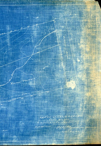
The collection includes a United States Geological Survey from 1907, property of town of Oyster Bay from 1950, and local maps of North Shore of Long Island. Within the map collection there are several maps, of which some are in very fragile condition, based upon properties owned or leased by the Brooklyn Institute of Arts and Sciences Biological laboratory, The Long Island Biological Association and the Carnegie Institution of Washington. Date ranges are from 1904–1947.

Availability of Material
For specific information on the availability of materials or to arrange an appointment to use the Archives, please contact 516-367-8414 or archives@cshl.edu. Please consult our Permissions & Copyright Policies for any materials you wish to use.
 This collection was processed under a 2011-2012 DHP award. Funding provided by the New York State Education Department’s Documentary Heritage Program.